
Leander Previous Residents Sources
A backward trail uses sources with different dates and purposes. Start with the appraisal parcel card to anchor the physical location, then use the clerk’s index to identify recorded transfers. Historical directories and the released federal census can add household context, while permits, probate, newspapers, and obituaries can explain a change at the address. None of those sources is a complete list of who lived there before, and a deed grantee should stay labeled as a recorded owner unless separate evidence ties that person to the house.
| Source | Years It Covers | Where Held | What It Shows |
|---|---|---|---|
| Williamson County deed and land records | County records begin in 1848; legacy and current portals split by era | County Clerk, Kofile/Tyler, archive, and research library | Recorded transfers, liens, plats, and legal descriptions |
| Williamson direct and reverse deed indexes | 1835-1887 and 1885-1904 ranges in the TSLAC guide | TSLAC/Baylor finding aid and county materials | Grantor and grantee routes into older deeds |
| Historical city directories | Austin examples from 1877 and 1889-1958; Leander run not verified | UT Briscoe, TSLAC, library, and UNT | Dated household or address snapshots when a relevant edition exists |
| Federal census | Released public census records under the 72-year rule | National Archives and library databases | Household composition and area context, not guaranteed street continuity |
| Leander permit history | Historic permit-data links include 2010-2018; current coverage not stated | City Forms and Development Hub | Construction, inspection, application, or plan chronology |
For a recent period, the parcel card and clerk index are the practical first pair. For an older period, move from the modern portal to legacy index books, physical or microfilm records, TSLAC guidance, and the county research channels. A date range in a finding aid identifies a possible source. It does not guarantee that every page is digitized or available remotely.
Leander Previous Residents Parcel Start
Begin at the Williamson Central Appraisal District property search when the Leander parcel is in Williamson County. Search by name, address, account, or property identifier, and use the advanced search when the address is incomplete. The property card can provide an account, owner name, situs address, mailing address, legal description, subdivision, block, lot, neighborhood, and tax-year information. Take the legal description and the exact printed owner name to the clerk’s land-record index.
A WCAD property-card sample shows the sort of labels used to anchor a prior-resident search.
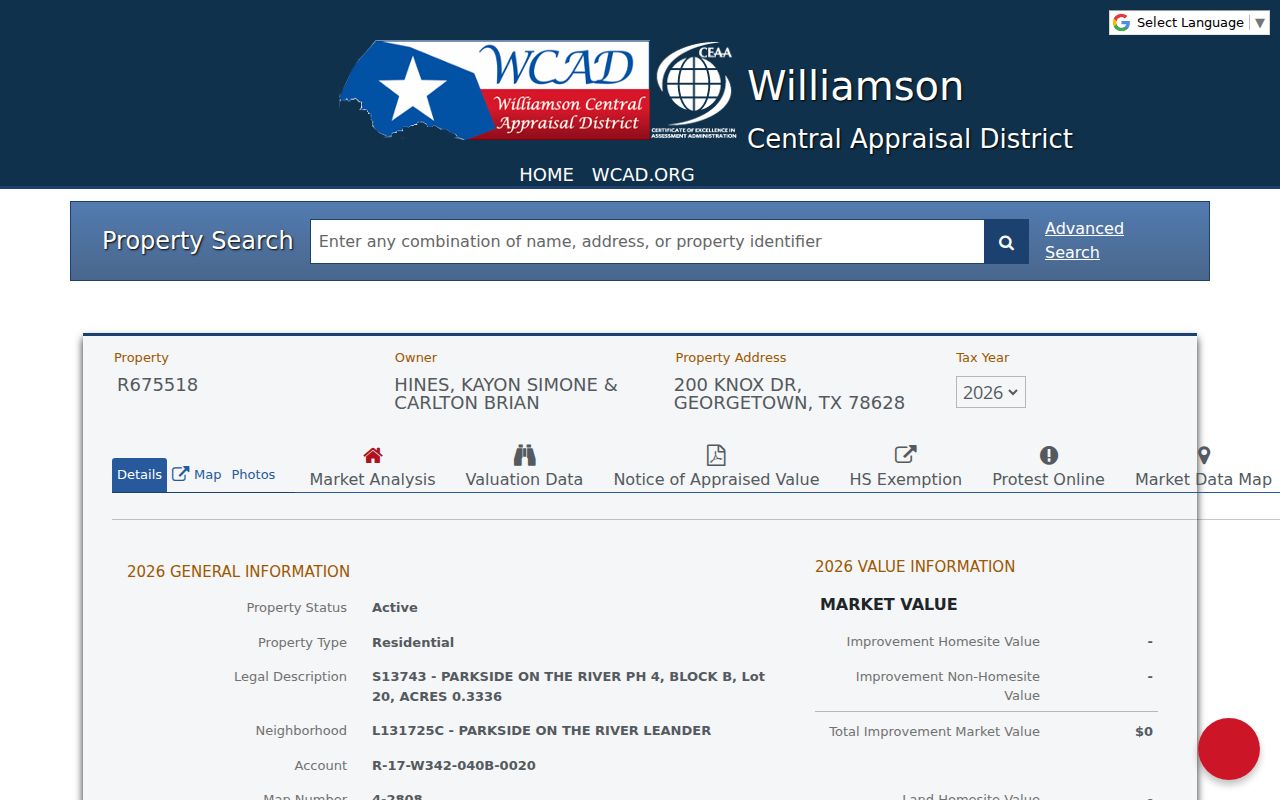
The card is an appraisal record, not a complete title chain or occupancy record. Its situs address is the physical location on the map. Its mailing address is where tax correspondence goes, and the two can differ. A mailing address may belong to a trust, agent, family member, business, or another residence, so it should not be treated as proof of who lived at the Leander house.
- Situs address
- The physical parcel location used for appraisal and mapping.
- Mailing address
- The address used for tax correspondence. It can differ from the situs address and is not occupancy proof.
- Legal description
- The lot, block, subdivision, tract, abstract, or survey wording that connects records when a street address changes.
Before selecting a clerk or appraisal district, confirm the county. Leander overlaps Williamson and Travis County, so a Leander postal label alone does not establish jurisdiction. A Travis parcel belongs in the Travis CAD and Travis County Clerk systems, not the Williamson trail.
Note: Keep the parcel’s situs address and its mailing address separate in every prior-resident research note.
Leander Previous Residents Deed Chain
The Williamson County records-search page routes land research to its official systems. The County Clerk’s guidance says a legal description alone is not an index key. Use the exact grantor or grantee name and a date range, then compare the legal description in each instrument. A transfer can involve a deed, release, lien, plat, restriction, easement, or another recorded event. It establishes a recorded event, not the date a person moved in or the identity of every household member.
- Pull the current parcel card and record its account, situs address, exact owner name, and legal description.
- Search the owner as grantee in the appropriate Clerk index for the likely purchase or transfer period.
- Open the instrument or request the copy, then record execution date, recording date, grantor, grantee, instrument number, volume or page, and legal description.
- Search that seller as a prior grantee, repeating the comparison of the legal description at each transfer.
- Use the plat and GIS to confirm the same parcel when a later lot description becomes an older abstract, survey, or metes-and-bounds description.
- Label any person as recorded owner until a directory, census, probate, newspaper, or other dated source supports a household connection.
- Grantor
- The person or entity transferring an interest in a recorded instrument.
- Grantee
- The person or entity receiving that interest. A grantee is not automatically an occupant.
- Chain of title
- A documented sequence of recorded transfers for the same legal parcel, checked one instrument at a time.
The legal description is the constant to test. Street names, lot numbers, and parcel configuration can change after a replat or division, while the records must be read in the form used at the time.
Leander Previous Residents Index Cutoffs
Williamson County’s legacy Kofile QuickLink offers remote search controls for index books and documents. Its visible fields include type, year, alpha, category, book, volume, and page. The research record says remote access reaches Commissioners Court minute index books through December 30, 1983 and deed volumes 1-150. Records from January 1984 to the present are in the county land-record system, though current portal results and access controls should be confirmed at the time of use.
The legacy index screen shows the book, volume, and page route used when Leander previous residents research moves beyond a modern name search.
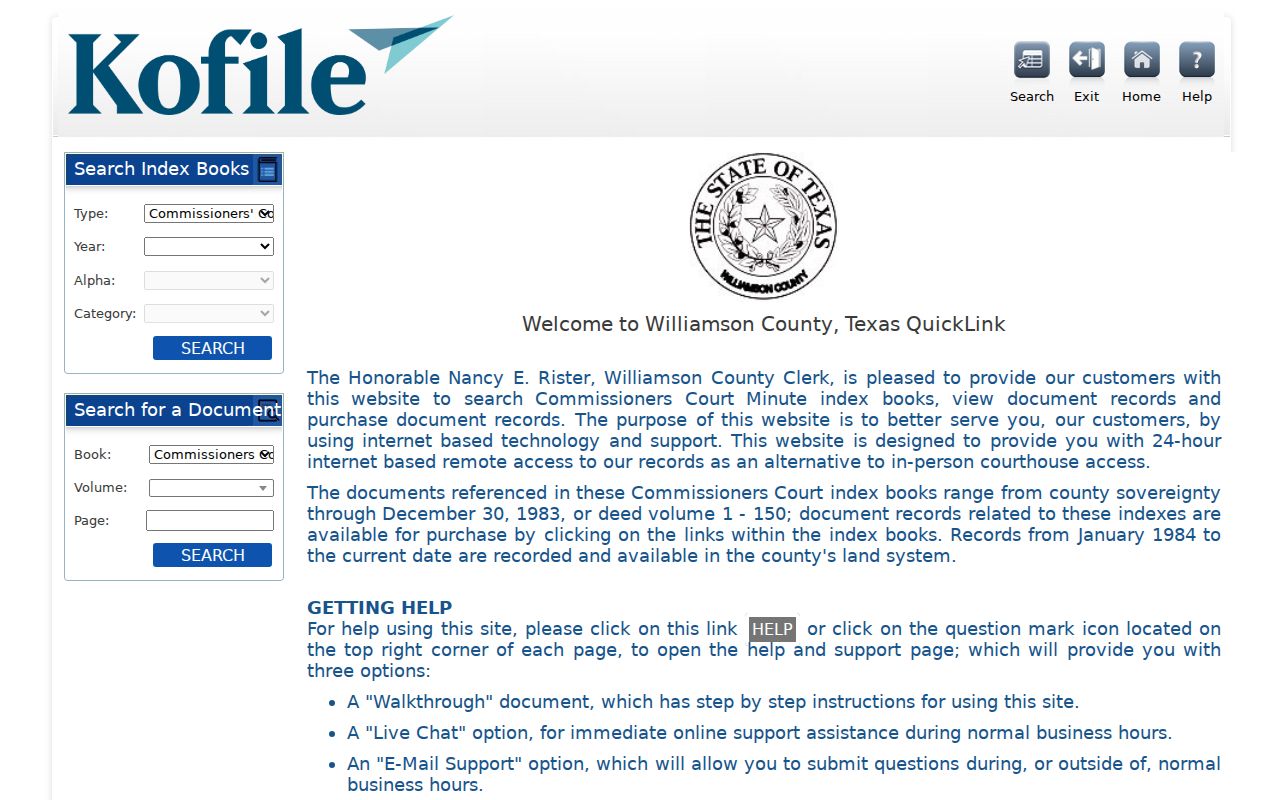
When the online path ends, move to the County Clerk research library, older deed volumes, microfilm, the TSLAC or Baylor finding aid, or a paid clerk copy. The archive plan reports that deed books 1-168 were preserved from 2001 through 2006 and that public computer or internet book-page lookup became part of later preservation work. Preserve the original volume and page even when a scan is available.
Note: A portal cutoff marks a change in access method, not the end of the property’s recorded history.
Leander Previous Residents Place Names
Old place names can hide the first useful record. The City of Leander history places Bagdad about one mile west of present Leander, notes that Bagdad was officially named in 1855, and describes the railroad’s arrival in 1881. Leander was established in 1882 after the railroad bypassed Bagdad. For early previous-resident work, test Bagdad, Leander, depot, railroad, and Old Town language rather than assuming the modern city name appears in every source.
The city history page records the Bagdad-to-Leander transition that affects an old address or deed search.

Railroad-era references to merchants, land parcels, granite, limestone, depots, or transport may be useful context. They remain separate source types. A historical mention can narrow a search term without proving that someone resided at a particular Leander address.
Leander Directory and Census Context
Ownership is only one layer of a Leander house history. A historical city directory can show a household or address snapshot by edition, but the research did not locate a verified Leander-specific year run. UT Briscoe holds the Cedar Park, Leander, Northwest Austin Blue Phone Book title, while TSLAC, UNT, the Leander Library, and the Williamson County Genealogical Society offer research channels. Record the edition and page before linking it to an address.
Pair each confirmed directory row with the released federal census for the same period. Census material can supply household composition and area context, but it does not guarantee exact street continuity in every year. Test a disappearance with a later directory, probate, newspaper, obituary, deed, or permit record. Children, lodgers, recent arrivals, rural households, people without phones, and people who requested nonpublication may not appear in a directory.
- Build a dated row from the directory: title, publisher, year, page, printed name, and address.
- Check the prior and following editions with initials, surname variants, Bagdad, and Leander terms.
- Compare the directory year with the released federal census and record each source’s date separately.
- Use probate, newspaper, or obituary evidence as an endpoint clue, not as a replacement for a dated address record.
The collections and their access limits are detailed on the Leander City Directories page. The useful result here is a labeled sequence, not a guessed list of past residents.
Leander Previous Residents Archive Trail
Williamson County recordkeeping began when the Legislature created the county from Milam County on March 13, 1848. Georgetown became county seat in May 1848, and the first district court met in October. Those dates help establish the beginning of county records, not the location of every Leander transaction. For older research, the official 1848-1849 county chronology is a source for the county context.
The official chronology provides the county-record origin behind a long Leander previous-residents search.
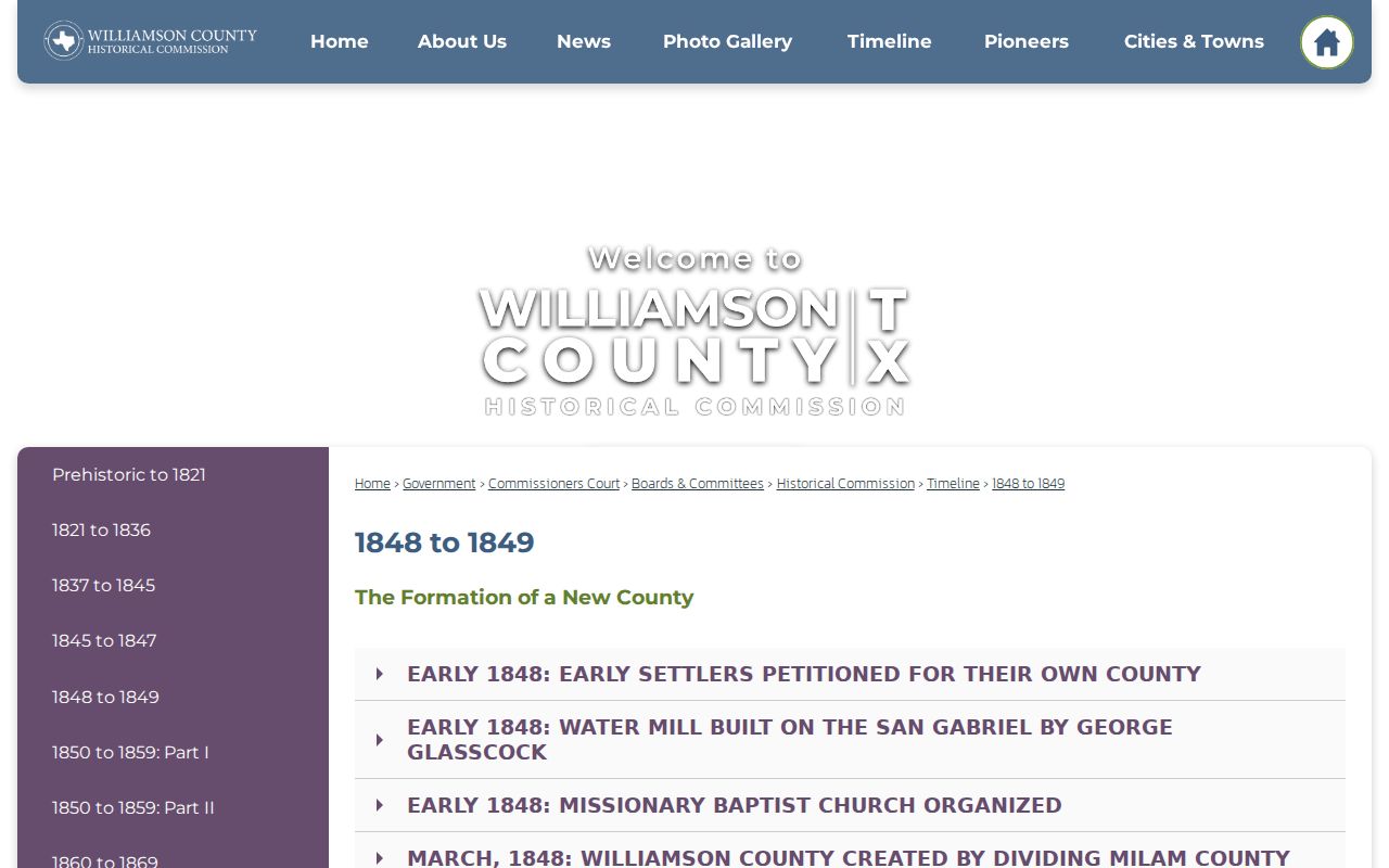
The Williamson County history adds that the county was organized in 1848. The archive plan records later preservation of deed books, marriage indexes, probate, plats, and microfilm. That preservation story explains why a case may require an archive, library, microfilm, or clerk channel after an online search rather than a claim that all older Leander records are available on the web.
Lawful Leander House History
Previous-resident research is most useful for family history, estate questions, and the history of a property. Keep a source card for every assertion: county, CAD account, tax year, situs address, legal description, plat or subdivision, clerk volume-page or document number, source role, and last-checked date. Sensitive mailing fields and security details do not belong in a public house-history note.
Lawful use. Use a Leander address trail for personal, historical, or estate research. Texas law prohibits stalking and harassment; do not use public records to track, expose, or harm a living person.
A strong trail also keeps its uncertainty. State whether a record identifies a recorded owner, a directory household, a probate party, a permit applicant, or a census household. The role and date matter as much as the name.
Note: A careful house history records both the supporting source and the gaps that remain unresolved.